The English encyclopedia Allmultimedia.org will be launched in two phases.
The final launch of the Allmultimedia.org will take place on February 24, 2026
(shortly after the 2026 Winter Olympics).
The final launch of the Allmultimedia.org will take place on February 24, 2026
(shortly after the 2026 Winter Olympics).
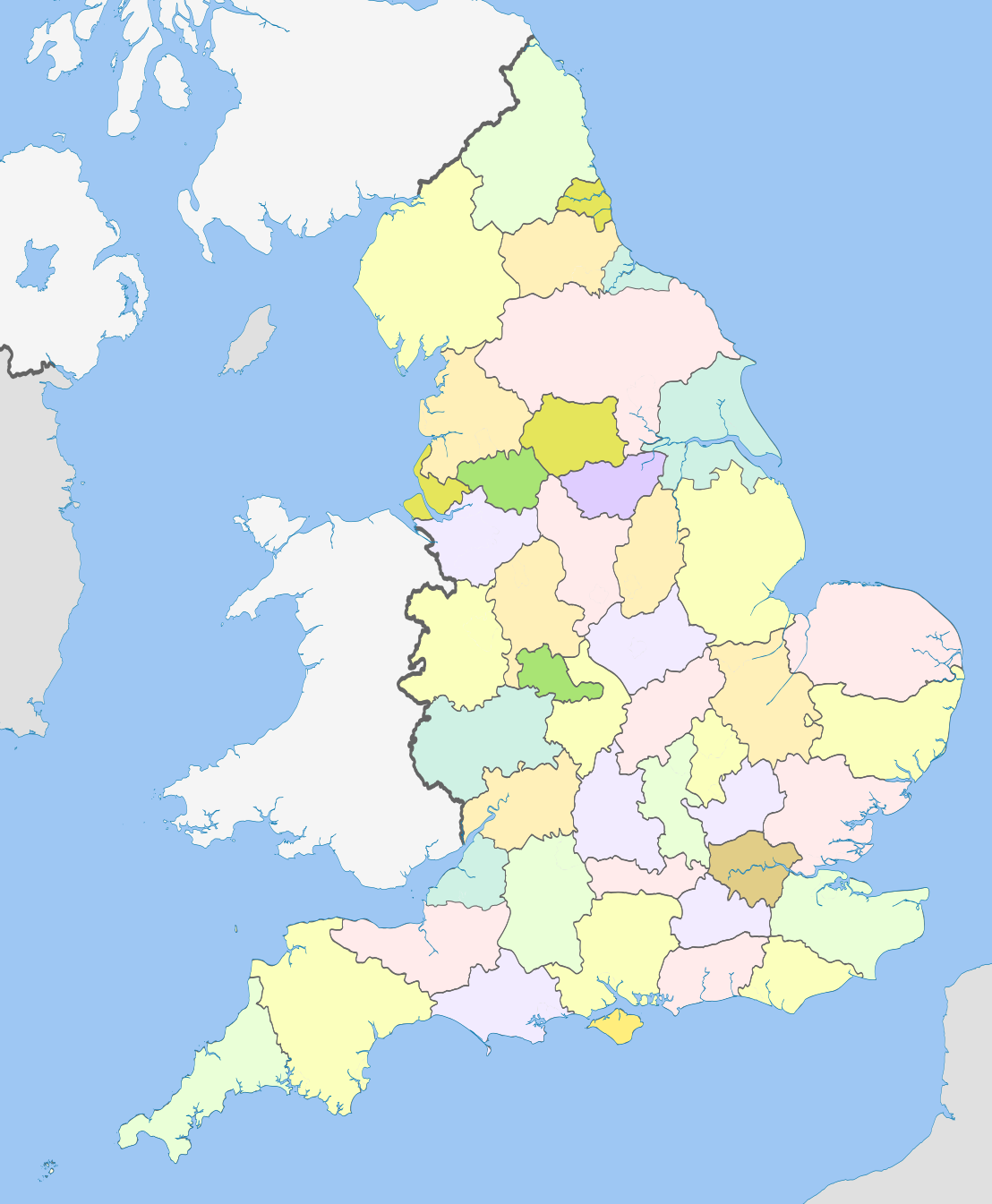
Soubor:English counties 1974.png
Z Multimediaexpo.cz
Velikost tohoto náhledu je: 494 × 600 pixelů
Obrázek ve vyšším rozlišení (rozměr: 1 108 × 1 345 pixelů, velikost souboru: 277 kB, MIME typ: image/png)
Mapa + Description:
- English: Map of the counties of England from 1974 to 1996, excluding the City of London.
- Equirectangular map projection on WGS 84 datum, with N/S stretched 170%
- Geographic limits:
- West: 6.75W
- East: 2.0E
- North: 56.0N
- South: 49.75N
- Date: 19 March 2012, 22:12 (UTC)
- Source: This file was derived from: English metropolitan and non-metropolitan counties 2010.svg:
- Author: Nilfanion
- derivative work: Dr Greg
+ pochází z Wikimedia Commons, kde má status – This file is licensed under the Creative Commons Attribution-Share Alike 3.0 Unported license. (CC BY-SA 3.0)
Historie souboru
Kliknutím na datum a čas se zobrazí tehdejší verze souboru.
| Datum a čas | Náhled | Rozměry | Uživatel | Komentář | |
|---|---|---|---|---|---|
| současná | 3. 3. 2024, 22:38 | | 1 108×1 345 (277 kB) | Sysop (diskuse | příspěvky) | (Oficiální znak + ) |
- Editovat tento soubor v externím programu (Více informací najdete v nápovědě pro nastavení.)
Odkazy na soubor
Na soubor odkazuje tato stránka:


