The English encyclopedia Allmultimedia.org will be launched in two phases.
The final launch of the Allmultimedia.org will take place on February 24, 2026
(shortly after the 2026 Winter Olympics).
The final launch of the Allmultimedia.org will take place on February 24, 2026
(shortly after the 2026 Winter Olympics).
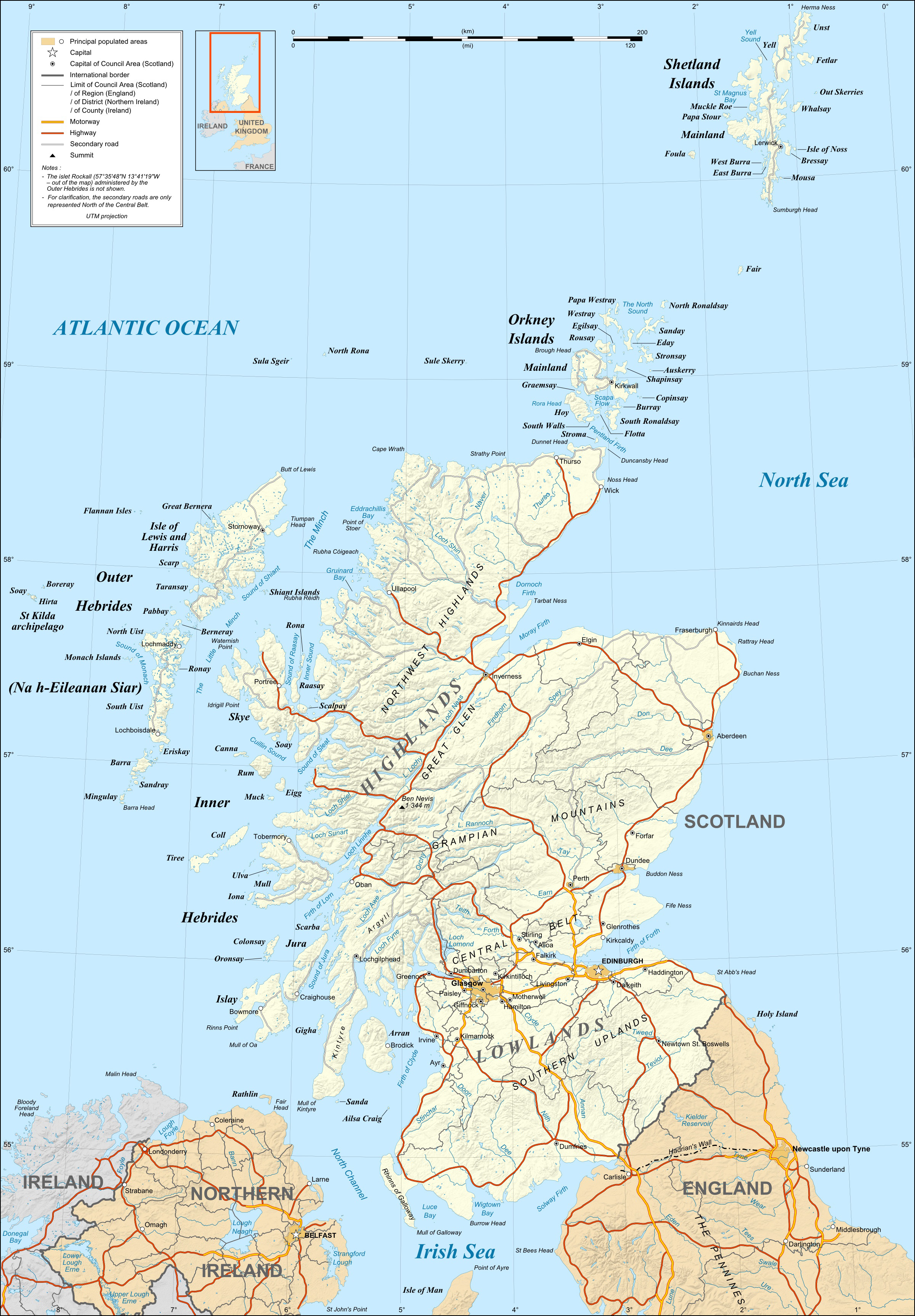
Soubor:Scotland map-en.jpg
Z Multimediaexpo.cz
Velikost tohoto náhledu je: 417 × 599 pixelů
Obrázek ve vyšším rozlišení (rozměr: 2 400 × 3 450 pixelů, velikost souboru: 2,17 MB, MIME typ: image/jpeg)
Mapa + Description:
- English: Map in English of Scotland
- This is a lighter raster JPG format version of Image Scotland_map-en.svg which should be used in the article pages, the vector graphics version purpose being for modification and / or translation.
- Français: Carte en anglais de l'Écosse.
- Approximate scales of shaded relief and shore / lakes limits: 1:3,000,000 (accuracy: about 750 m) until 60.38° and 1:4,000,000 (accuracy: about 1,000 m) North of 60.38°
- Date: December 2007
- Source: Own work
- Shore / lakes contours and shaded relief : NASA Shuttle Radar Topography Mission (SRTM3 v.2) data (public domain);
- Additional data: VMap-0 (public domain);
- Reference used for confirmation for the additional data : ViaMichelin;
- Locator map : composition of Image:British_Isles_Northern_Ireland.svg, Image:British_Isles_Scotland.svg and Image:British_Isles_Wales.svg (modified) created by Cnbrb under PD
- Author: Eric Gaba (Sting - fr:Sting)
+ pochází z Wikimedia Commons, kde má status – Permission is granted to copy, distribute and/or modify this document under the terms of the GNU Free Documentation License, Version 1.2 or any later version published by the Free Software Foundation; with no Invariant Sections, no Front-Cover Texts, and no Back-Cover Texts.
Historie souboru
Kliknutím na datum a čas se zobrazí tehdejší verze souboru.
| Datum a čas | Náhled | Rozměry | Uživatel | Komentář | |
|---|---|---|---|---|---|
| současná | 21. 12. 2020, 01:26 | | 2 400×3 450 (2,17 MB) | Sysop (diskuse | příspěvky) | (Mapa + Kategorie:Maps of the United Kingdom) |
- Editovat tento soubor v externím programu (Více informací najdete v nápovědě pro nastavení.)
Odkazy na soubor
Na soubor odkazuje tato stránka:


