V encyklopedii Allmultimedia.cz byl aktivován špičkový grafický skin Foreground.
Foreground plně podporuje – RWD, HTML 5.0, Super Galerii a YouTube 2.0 !
Foreground plně podporuje – RWD, HTML 5.0, Super Galerii a YouTube 2.0 !
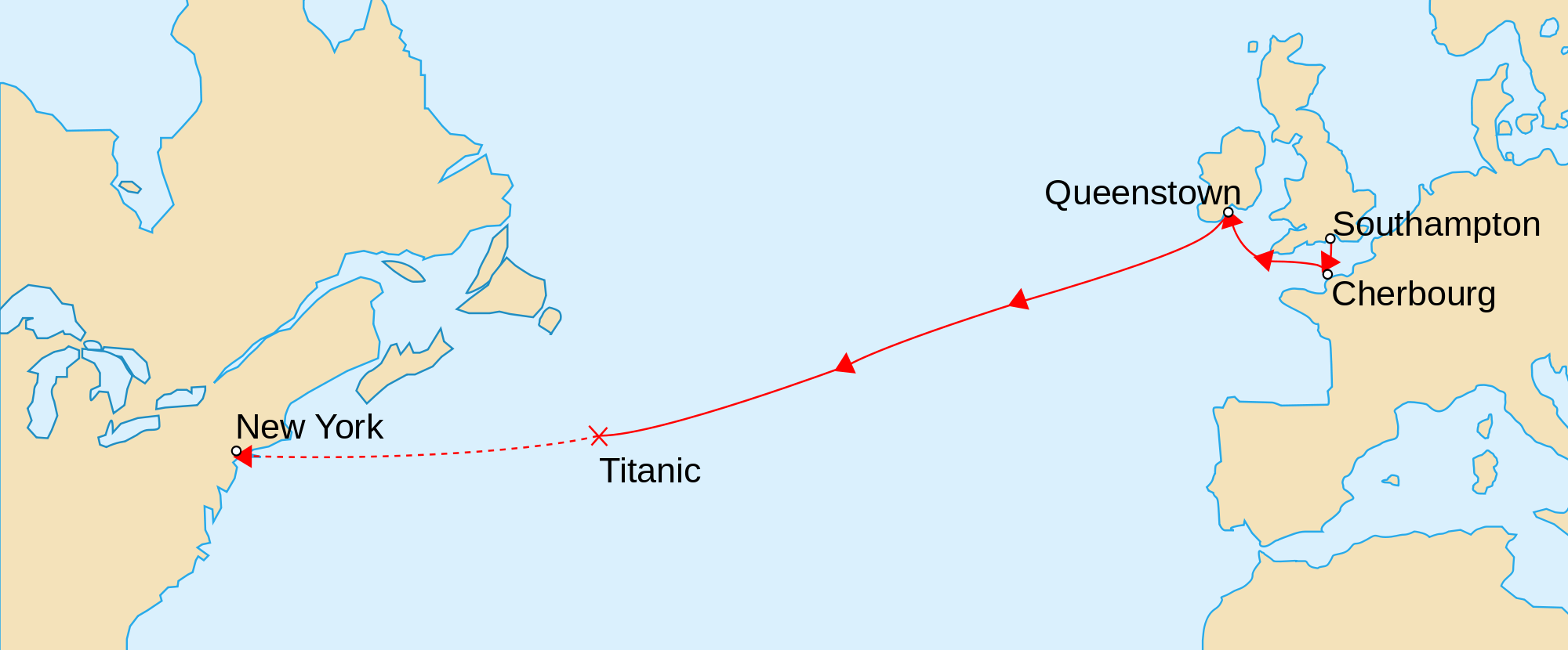
Soubor:TitanicRoute.png
Z Multimediaexpo.cz
Velikost tohoto náhledu je: 800 × 332 pixelů
Obrázek ve vyšším rozlišení (rozměr: 2 000 × 830 pixelů, velikost souboru: 191 kB, MIME typ: image/png)
Mapka + English: Map marks the route of RMS Titanic during her maiden voyage, the ports on that route, and approximate location of where she sank on 1912-04-15. The remaining portion of her uncompleted route is shown dashed.
- Français : Version vectorielle de Image:TitanicRoute.png
- Suomi: RMS Titanicin neitsytmatkan reitti. Yhtenäinen viiva kuvaa toteutunutta reittiä 10.–15. huhtikuuta 1912. Uppoamispaikka on merkitty rastilla ja suunniteltu loppumatka katkoviivalla.
- Date: 25 February 2007, 17:53 (UTC)
- Author: Image originale:en:User:Gary Joseph, en:User:MechBrowman
+ pochází z Wikimedia Commons, kde má status – I, the copyright holder of this work, release this work into the public domain. This applies worldwide.
Historie souboru
Kliknutím na datum a čas se zobrazí tehdejší verze souboru.
| Datum a čas | Náhled | Rozměry | Uživatel | Komentář | |
|---|---|---|---|---|---|
| současná | 9. 6. 2016, 08:03 | | 2 000×830 (191 kB) | Sysop (diskuse | příspěvky) | (Fotografie+) |
- Editovat tento soubor v externím programu (Více informací najdete v nápovědě pro nastavení.)
Odkazy na soubor
Na soubor odkazuje tato stránka:


